Across centuries under the cartographer’s pen, Roatan changed shape: from rectangular to curved, from meandering to square. Even the island’s distance from the other Bay Islands has varied over the years.
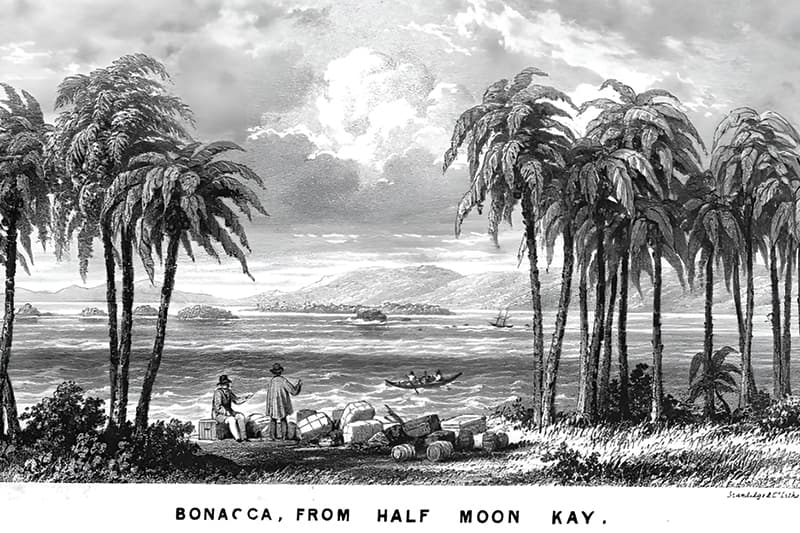
English, Spanish, French and even Italians created maps of the Bay of Honduras and Bay Islands beginning in the 1500s. The oldest geographical references to Roatan marked it with quite different names. An Italian cartographer Isolario del P. Corelli marked it by a evocative name, Laymoda Island. A French Map dated to 1650 marked Roatan as Guayama and another map has it as Isla de Guajama. Yet another XVII century cartographer drew a Latin map and designated Roatan as Isola de Leya. While the name of Roatan became more common in 1700s, it still had several variations: Ruatan, Rattan, Rotan before it finally settled.
The 1740s brought much better cartographers to Roatan, most of them were English. The best, most detailed map of Roatan was done by the English Lieutenant Henry Barnsley in 1742 who described the island writing: “The Island of Rattan is exceedingly well situated for trade, both with the Bay of Honduras, and the Spaniards of the Provinces of Honduras and Guatemala. The South side is very convenient for Shipping, having many fine Harbours from one end to the other…” The English maps designated the meandering Roatan southern coast with different geographical terms. In the 1740s maps marked Roatan full of Bays, Lagoons and Coves, and it seems that most terms were interchangeable. Dalrymple Bay is now called Neversteen Bight and Oak Ridge now occupies the area once marked as Pitts Lagoon. Cochman’s Creek is now called Second Bight.
English cartographers Roatan ended up with more French Harbours then English Harbours
Curiously, despite the work of all these English cartographers Roatan ended up with more French Harbours then English Harbours. There was the Old French Harbour and the New French Harbour. The English had a Harbor as well, now called Brick Bay. There were no Spanish Harbors on any maps I have found.
Definitions also changed over time. What was once considered an island is today a cay. What was once a bay is now a bight. Poinsetts island is now Stamp Cay just west of Dixon Cove. What are called bights today, on southern side or Roatan, were called lagoons, mostly. Gibson Bight changed names several times: it was called Turtling Bay and at one time Oyster Bite. Mangrove Bight was called Cohoon Bight.
Roatan has an unwritten rule that an owner has the right to change the name of the cay… and often that is the case. Some Roatan places changed their names as their owners changed. Bennets Island became Osgood Cay and now it is called Maya Cay.
Names can also flip, a name can migrate. Sandy Bay was not designated as a bay on any maps before the XX century and today’s Camp Bay was actually called Sandy Bay in 1700s. Coxen Hole used to be called Caulkett’s Hole, and even appeared as Roatan City in the 1990s. Though marketing a place called “hole” to tourists and cruise shippers is an uphill struggle, one that might never be won.
Still some things stay the same, despite names that change, move, or relocate. Naming places can be a political tool, a tool of glorification, or even a marketing tool. So next time you’ll find yourself trying to make a left turn at Peru Plaza, ask yourself why Peru?